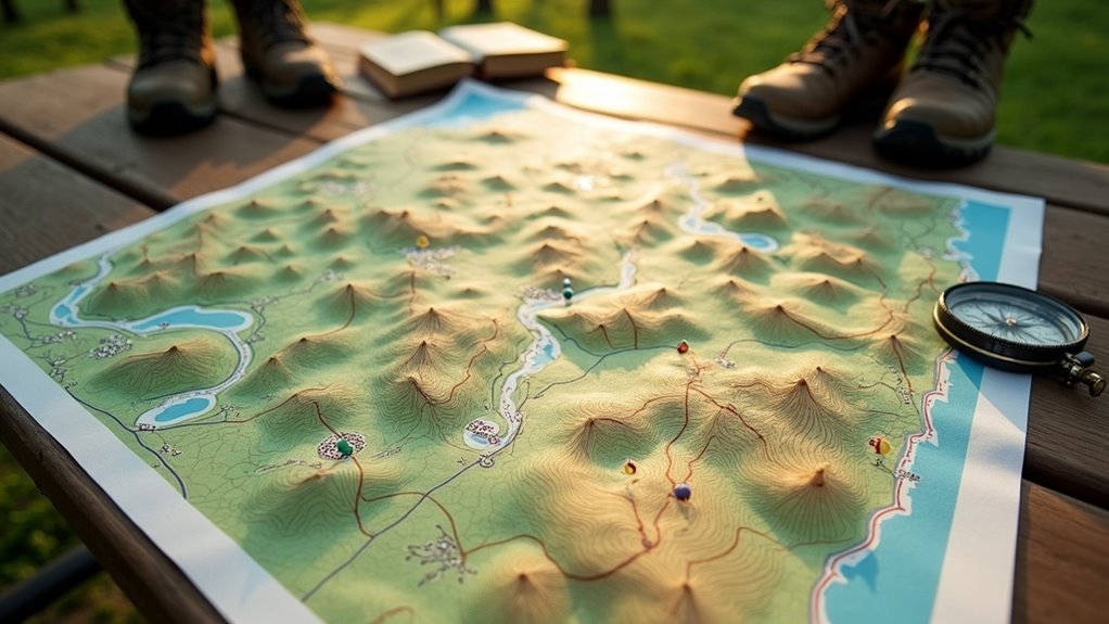
Contour lines on hiking maps show elevation changes and terrain steepness, helping you navigate varied landscapes effectively. Closely spaced lines indicate steep slopes, while wider spacing suggests gentler terrain. Understanding these lines is essential for evaluating hike difficulty and selecting safe routes. Peaks are marked by closed circles, and valleys by U or V shapes, guiding your exploration. If you’re curious about how to further utilize these features for safer hikes, there’s much more to discover.
Key Takeaways
- Contour lines indicate elevation changes, helping hikers assess the steepness of terrain before embarking on a trail.
- Closely spaced contour lines signal steep slopes, while wider spacing suggests gentler terrain for easier hiking.
- Circular contour lines represent hills or peaks, aiding in navigation around challenging climbs.
- Valleys and saddles are identified by U or hourglass shapes, indicating easier routes for crossing between elevations.
- Topographic maps enhance safety by visualizing terrain features, allowing hikers to plan routes effectively based on elevation gain or loss.
Understanding Contour Lines
Contour lines serve as a fundamental tool for hikers, offering a detailed view of the terrain’s elevation. Each line represents a specific elevation on a topographic map, and the contour interval—typically ranging from 5 to 50 feet—indicates the vertical distance between these lines.
When you observe closely spaced contour lines, it signals steep terrain, essential for evaluating trail difficulty. Conversely, wider spacing suggests gentler slopes.
Circular lines depict hills or peaks, while hachured lines mark depressions. By understanding these geographical features, you can effectively plan routes, anticipate changes in elevation, and enhance your overall hiking experience.
Analyzing Elevation Changes
When analyzing elevation changes on hiking maps, you’ll notice that the spacing of contour lines is vital for understanding the terrain’s steepness. Closely spaced contour lines indicate steep slopes, while widely spaced lines suggest gentler terrain.
The contour interval, which defines the vertical distance between adjacent lines, helps you estimate elevation gain or loss. For instance, with a 20-foot contour interval, crossing five lines results in a 100-foot elevation change.
Recognizing these variations is important, as gradients of 800-1,000 feet per mile are steep and may pose significant challenges. Analyzing contour lines equips you to navigate effectively.
Importance of Topographic Maps
Understanding the importance of topographic maps is essential for effective hiking navigation and planning, as these maps offer detailed representations of terrain features and elevation changes.
By using topographic maps, you can:
- Assess steepness and slope through contour lines.
- Visualize elevation gain or loss to estimate hike difficulty.
- Identify natural features like ridges, valleys, and depressions.
- Choose superior paths for safer navigation.
Familiarity with these maps not only enhances safety by providing insights into the terrain but also improves your overall hiking experience, enabling better route selection and navigation on your adventures.
Identifying Landmarks With Contour Lines
As you navigate hiking maps, recognizing landmarks through contour lines is essential for effective route planning.
Contour lines reveal the shape of the land, indicating peaks with closed concentric circles that denote elevation. Steep climbs are highlighted by V-shaped ridges, guiding you around challenging areas.
Valleys, marked by U or V shapes, suggest easier hiking paths and potential water flow. Look for saddles, characterized by hourglass shapes, as they provide lower crossing points between peaks.
Additionally, depressions indicated by hachured lines signal low-lying areas to avoid, especially in wet conditions, ensuring a safer and more efficient hiking experience.
Tools for Accessing Topographic Maps
Recognizing landmarks through contour lines enhances your navigation, but accessing topographic maps is just as important for effective planning.
Here are some tools for accessing these essential resources:
- Google Maps: Utilize the terrain layer to visualize contour lines and elevation changes.
- Gaia GPS: Download topographic maps offline with a membership for additional features.
- Backcountry Navigator: Access Android topographic maps, with a demo version available.
- Caltopo: Create custom topographic maps online, including route drawing and collaboration options.
These tools help you assess steeper slopes and sea level variations, ensuring your hiking maps are accurate and reliable.